| |
AVALANCHE CREST

Avalanche Crest is the ridge to the southeast of Rogers Pass in Glacier National Park.
The trail head, along with several others which lead to alpine areas, is located near
the Illecillewaet campground at 1250 meters elevation.
We did this hike on August 17 2003, at a time when hundreds of fires were burning
throughout British Columbia. The views were consequently nearly completely obscured
by smoke.
|
|
Avalanche Crest [314 Kb]
|
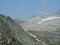
The first two hours of the walk are spent climbing through the forest, finally
breaking into the sub alpine in a large basin to the south of Avalanche Mountain.
Avalanche Crest, elevation 2045 meters, is gained by climbing the ridge to the West.
The views from Avalanche Crest are reputably some of the finest in the area. Most
of what we saw, and smelled, was smoke.
It was from this point that Major Rogers first viewed the pass in 1881 while surveying
for the Canadian Pacific Railroad.
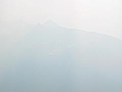
The day we did this hike, however, the Trans Canada highway 1000
meters below was barely visible. Also barely visible were Mount Sir Donald to
the east and Abbott Ridge to
the south.

|
|
Mount Sir Donald [183 Kb]
|
|
|
Abbott Ridge [63 Kb]
|
|