| |
PEEKABOO LOOP

|
|
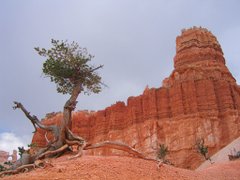
Bristlecone Pine [301 Kb]
|
Bryce Canyon was the first of the National Parks
in the American Great Plateau that we visited while
based at Kanab Utah.
We would visit
Zion Canon and the
North Rim
of the Grand Canyon on the following days.
Bryce Canyon is geologically the highest, or most recent,
of the three parks; the sedimentary layers at the bottom of
Bryce Canyon coincide roughly with the top layers at Zion, while the
bottom layers at Zion coincide with the top layers at the
Grand Canyon. The elevation of the canyon rim at Bryce Point
is 2539 metres. Although not mandatory,
we opted to take advantage the park shuttle bus, leaving our car
outside the park entrance and riding the shuttle to our trailhead
at Bryce Point.
The hike we chose, the Peekaboo Loop Trail, would descend
473 metres from the canyon rim for a highly
picturesque walk amongst the hoodoos for which Bryce Canyon
is famous. We did this trip on July 17, 2006.
|
|
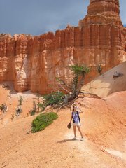
Along the Peekaboo Loop Trail [239 Kb]
|
From Bryce Point we descended along a trail for about
1.8 kilometers before reaching the Peekaboo Loop Trail,
which traverses 4.8 kilometers through the heart of the
Bryce Amphitheatre below Bryce and and Inspiration Points.
The weather was hot but reasonably comfortable, and we encountered
very few other hikers along the trail.
There were distant flashes of lightening and rumblings of thunder
all afternoon, but fortunately the deluge of rain didn't begin
until we were safely in the shuttle bus on our way back to our car.
The scale of the topography along this hike is such that the
scenery changes around every bend of the trail. The consequence
of this is that we all went a bit overboard in picture taking,
hence the large number of pictures included below. The pictures
were all taken either from Bryce Point or from the Peekaboo Loop Trail,
and most are without captions.
|
|
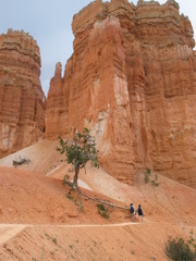
Peekaboo Loop Trail [192 Kb]
|
|
|
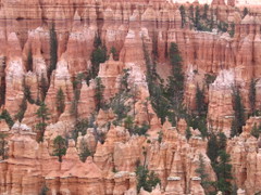
Hoodoos [549 Kb]
|
Other stuff:
Panoramic pictures
Other pictures
|