| |
EXCELSIOR PASS

|
|
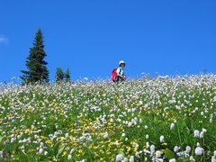
Meadows along the High Divide trail [227 Kb]
|
The high ridge on the north side of Mount Baker and the North Fork Nooksack River
runs in an east - west direction for about 15 kilometers from
Church Mountain
at the west to Welcome Pass at the east.
Ranging in elevation from 1600 to 1800 meters, the High Divide trail covers
the section of the ridge from its midpoint at Excelsior Pass eastwards to Welcome Pass.
Off-trail routes can be used to travel from Church Mountain to Excelsior Pass, or
northeastward from Welcome Pass to
Yellow Aster Butte
and Gold Run Pass.
Trail access to the High Divide trail is easiest via the Damfino Lakes trail,
which approaches Excelsior Pass from the north with only 320 meters elevation
gain over five kilometers.
One can also reach High Divide by the Excelsior Pass trail or the
Welcome Pass trail, however both of these involve much more elevation gain.
We've covered the entire High Divide ridge over the years, some parts many times over.
Most of the pictures shown here are from a hike on August 2, 2005 when
the alpine meadows were near their peak.
I also did the hike on snow in the
spring of 2009,
this time from the highway 542 trailhead, and again from the same trailhead early summer
the following year.
Other stuff:
Panoramic pictures
Other pictures
|